SpatialView Index
This is a collection of SpatialView specific spatialite issues
- which will, very soon, be supported by
geopaparazzi
--> 'List of Database-Designing'
--> 'List of Geopaparazzi Specific Themes'
--> 'Index Page for RasterLite2'
--> 'Index Page for GeoPackage'
'What is a 'SpatialView' and what it is not
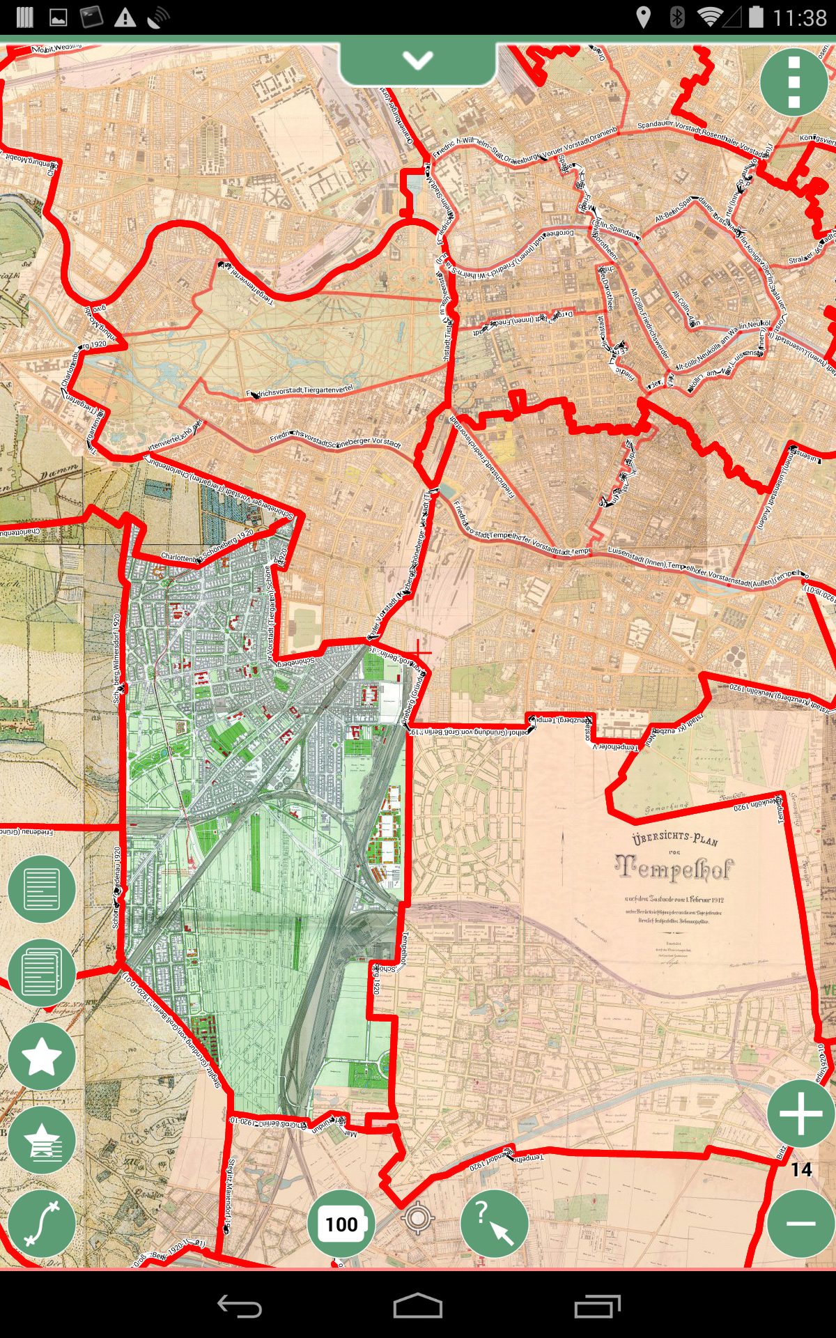
- this is an image of a collection of historical Berlin Maps around 1910 with
- District (Stadtteile) borders of 1912
- thin red lines
- District (Ortsteile) borders of 1920 after the founding of
Greater Berlin1920-10-01- thick red lines
- District (Stadtteile) borders of 1912
2014-05-23: Mark Johnson, Berlin Germany