RL2_GetMapImage
Loading a RasterLite2 Image from a Geo-Referenced File
<-- 'Index Page for RasterLite2 - Commands'
Original Documentation 'RasterLite2 SQL functions - reference list)'
- RL2_GetMapImage ( coverageName String , boundingBox BLOB-Geometry , width Integer , height Integer ) : BLOB
...
- RL2_GetMapImage ( coverageName String , boundingBox BLOB-Geometry , width Integer , height Integer , styleName String , mimeType String , bgColor String , transparent Integer , quality Integer , reaspect Integer ) : BLOB
- Retrieve a portion of the Raster-Image
- as
TILE
- as
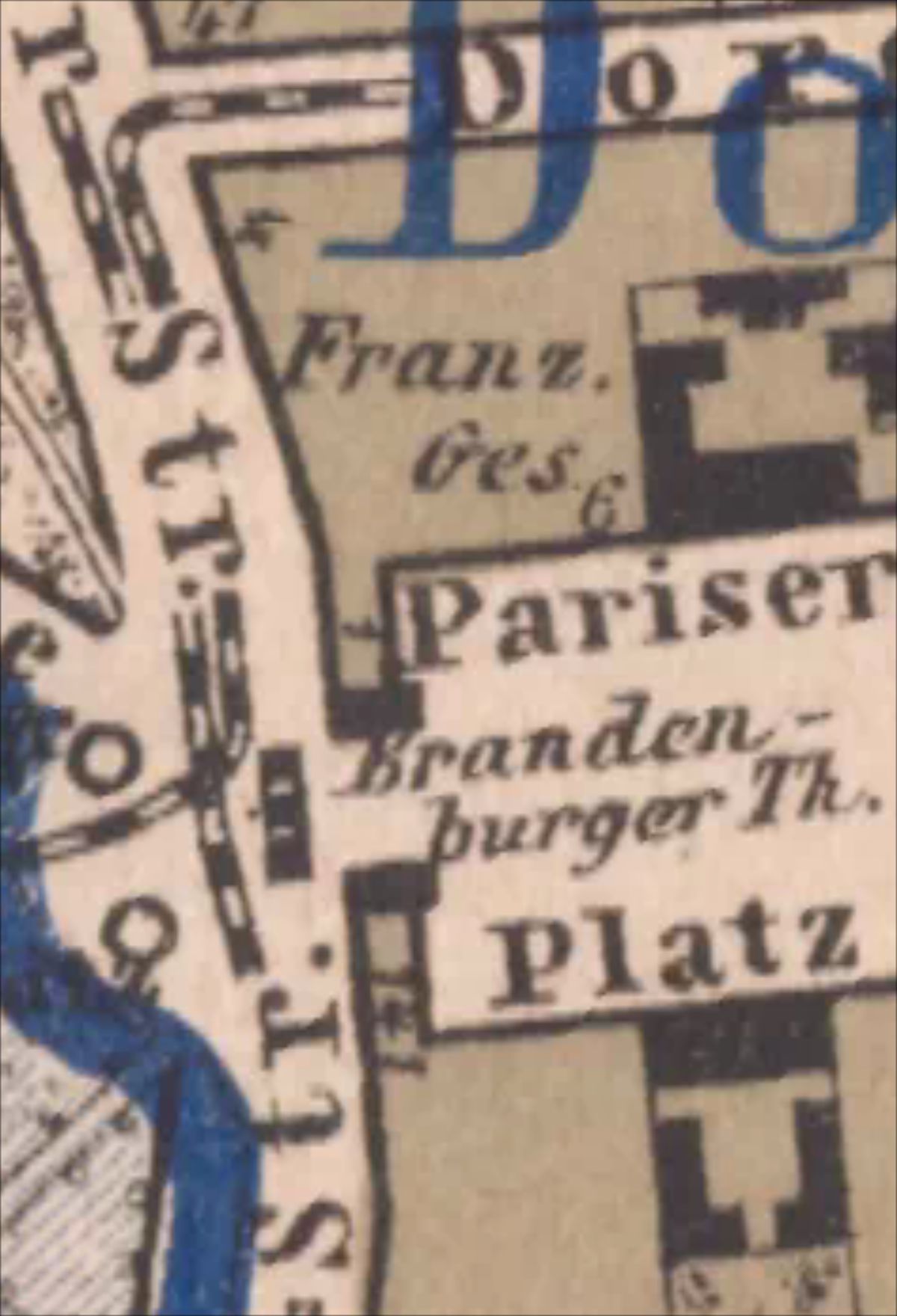
-- tile_osm : 18/140813/85975, tile_tms : 18/140813/176168
SELECT 'Brandenburger Tor Zoom 18',
 RL2_GetMapImage("berlin_stadtteilgrenzen.1880",
  ST_Transform
  (
   GeomFromEWKT
   ('SRID=4326;POLYGON((13.377227783 52.516220864,
13.377227783 52.517056554,
13.378601074 52.517056554,
13.378601074 52.516220864,
13.377227783 52.516220864))'
   )
  ,3068
  )
  -- image width,height
  256,256,
  'default',
  -- image-type jpeg
  'image/jpeg',
 );
--OR simplified as
SELECT
 'Brandenburger Tor Zoom 18',
 RL2_GetMapImage
 (
  "berlin_stadtteilgrenzen.1880",
  ST_Transform
  (
   BuildMBR
   (
    13.377227783,52.516220864,13.378601074,52.517056554,4326
   ),
   3068
  ),
  -- image width,height
  256,256,
  'default',
  -- image-type jpeg
  'image/jpeg',
  -- background
  '#ffffff',
  -- transparent
  0,
  -- jpeg quality
  80,
  -- 1 = adapt image width,height if needed
  1
);-
- the time needed in spatialite_gui
0.030 seconds
- the time needed in spatialite_gui
--
- as
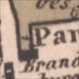
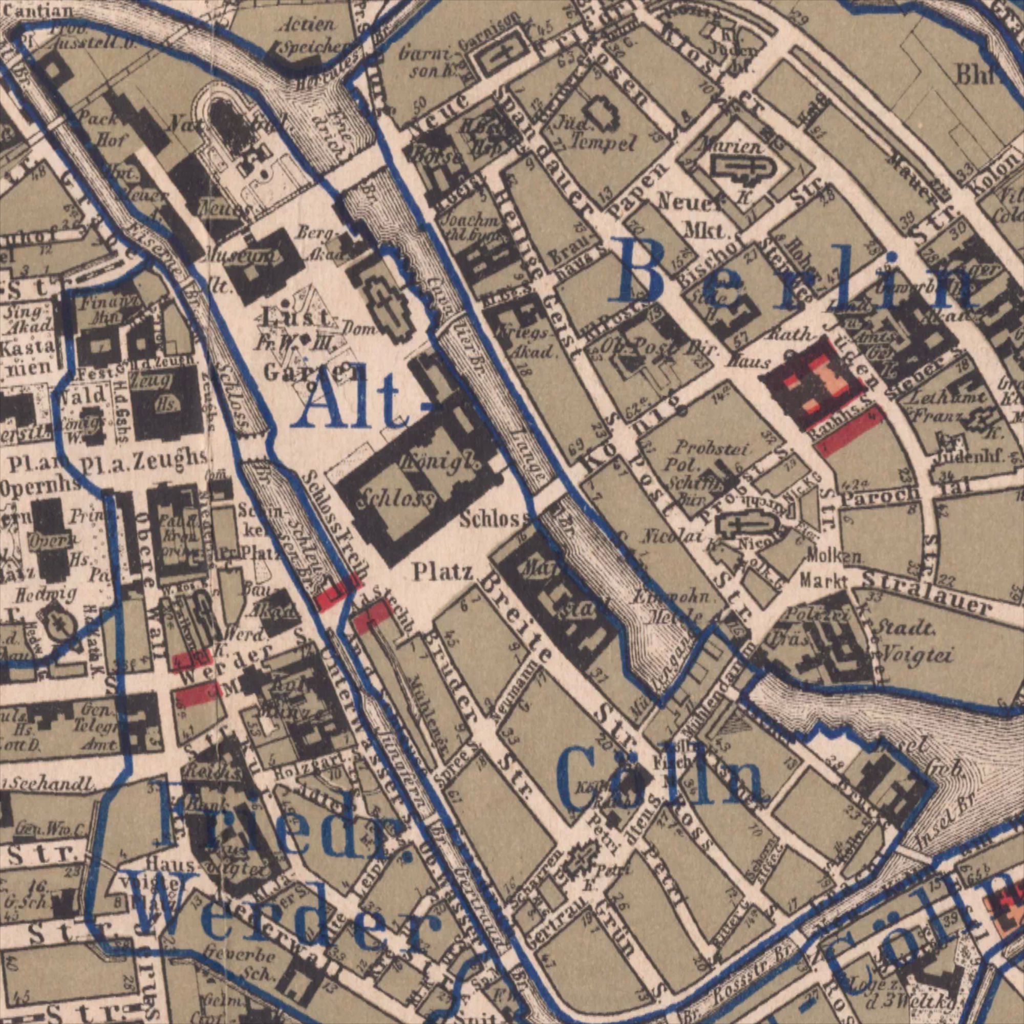
Geometry- the Geometry of the Stadtteil Alt-Cölln will be used
- to define the area to retrieve
- the Geometry of the Stadtteil Alt-Cölln will be used
SELECT 'Alt-Cölln',
 RL2_GetMapImage
 (
  "berlin_stadtteilgrenzen.1880",
  (SELECT Extent(soldner_linestring) FROM ortsteile_1912 WHERE name='Alt-Cölln'),
  -- image width,height
  2000,2000,
  'default',
  -- image-type jpeg
  'image/jpeg',
  -- background
  '#ffffff',
  -- transparent
  0,
  -- jpeg quality
  80,
  -- 1 = adapt image width,height if needed
  1
);-
- the time needed in spatialite_gui
0.470 seconds
- the time needed in spatialite_gui
--
- as
Random area- this is the
geopaparazzicommand to retrieve the active geometries of that area- at Zoom-Level 18 and further down Zoom 14
- the query is against a
SpatialView
- this is the
getGeometryIteratorInBounds query[
SELECT
 -- geometry for JTS Topology Suite Library
 ST_AsBinary(CastToXY(ST_Transform(soldner_linestring,4326))),
 -- label if active
 name
FROM
 -- table/viewname
 ortsteile_1912
WHERE
ST_Intersects
(
 soldner_linestring,
 ST_Transform
 (
  BuildMBR(13.376376,52.518039,13.379595,52.515144,4326),3068)
 ) = 1 AND
 id_geometry IN
 (
  SELECT id_geometry
  FROM Spatialindex
  WHERE
   f_table_name ='ortsteile_1912' AND
   f_geometry_column = 'soldner_linestring' AND
   search_frame =
   ST_Transform
   (
    BuildMBR(13.376376,52.518039,13.379595,52.515144,4326),
    3068
   )
  );
]- the same area as RasterLite2 command:
SELECT 'Brandenburger Tor Zoom 18',
 RL2_GetMapImage
 (
  "berlin_stadtteilgrenzen.1880",
  ST_Transform(BuildMBR(13.376376,52.518039,13.379595,52.515144,4326),3068),
  -- image width,height
  1200,1760
  'default',
  -- image-type jpeg
  'image/jpeg',
  -- background
  '#ffffff',
  -- transparent
  0,
  -- jpeg quality
  80,
  -- 1 = adapt image width,height if needed
  1
);-
- the time needed in spatialite_gui
0.170 seconds
- the time needed in spatialite_gui
-
and at Zoom level 14
- this took the longest to create in spatialite_gui
1.270 seconds
- this took the longest to create in spatialite_gui
-
2014-05-11: Mark Johnson, Berlin Germany