RL2_LoadRasterFromDir
Filling a Raster Coverage with Geo-Referenced Image-Files stored in a specific directory
<-- 'Index Page for RasterLite2 - Commands'
Original Documentation [RasterLite2 SQL functions - reference list)[(https://www.gaia-gis.it/fossil/librasterlite2/wiki?name=sql_reference_list)
- RL2_LoadRasterFromDir(text coverage, text dir_path, text file_ext, int with_worldfile, int force_srid, int pyramidize, int transaction)
Parameters [optional parameters]:
- coverage: chosen name of raster_coverage
- dir_path: directory where the files to be loaded are stored
- file_ext: file extension of the files in the directory to be loaded
- [with_worldfile]: (0= if geotiff, 1= if worldfile)
- [force_srid]: (0= if geotiff, 1= if worldfile)
- world files have no srid support build in
- this value will set the srid to be used
- geotiff, without a world file
- will ignore this value (can be 0)
- world files have no srid support build in
- [pyramidize]: calls
RL2_Pyramidize(notRL2_PyramidizeMonolithic) - [transaction]:
- Sample for a GeoTiff
- without a world-file
SELECT RL2_LoadRastersFromDir
(
-- chosen name of raster_coverage
'dritte_landesaufnahme_toscana_dir',
-- directory where the files to be loaded are stored
'../Dritte_Landesaufnahme.Toscana',
-- file extension of the files in the directory to be loaded
'.tif'
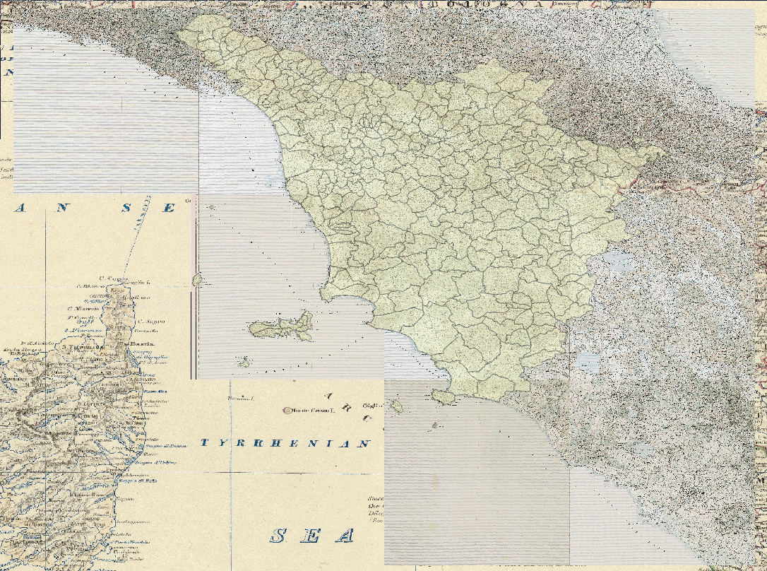
);The result in QGIS then looks like this
- background: 1861 map of Northern Italy
- geometries: presen day borders of the Toscanna
- Geotiff : 1904-12 maps in the directory Dritte_Landesaufnahme.Toscana
2015-09-01: Mark Johnson, Berlin Germany