Skip to content
New issue

Have a question about this project? Sign up for a free GitHub account to open an issue and contact its maintainers and the community.

By clicking “Sign up for GitHub”, you agree to our terms of service and privacy statement. We’ll occasionally send you account related emails.

Already on GitHub? Sign in to your account

Tasking Manager 新規プロジェクト用 Markdown テンプレート #4

Open
mapconcierge opened this issue Sep 16, 2019 · 9 comments
Assignees

Comments

@mapconcierge
Copy link
Member

mapconcierge commented Sep 16, 2019

プロジェクト名命名ルール v1.0

English

  • 災害名称(アジア名), 年, マッピング対象, ローカルエリア名, 都道府県名, Japan
  • Sea of Japan earthquake, 2024 Building and Road Mapping. Suzu, Ishikawa, Japan
  • Sea of Japan earthquake, 2024 Building and Road Mapping. Wajima, Ishikawa, Japan
  • Typhoon Fah-sai, 2019 Building Mapping. Kimitsu, Chiba, Japan
  • Heavy Rain/Flood, 2019 Road Mapping. Omachi, Saga, Japan
  • Kumamoto Earthquake, 2019 Landslide Mapping. Mashiki, Kumamoto, Japan
  • Typhoon Fah-sai, 2019 Building Mapping. Kyonan, Chiba, Japan
  • Typhoon Fah-sai, 2019 Building Mapping. Ni-jima, Tokyo, Japan
  • Typhoon Fah-sai, 2019 Building Mapping. Nagara, Chiba, Japan
  • Typhoon Hagibis, 2019 Building Mapping. Nagano city, Nagano, Japan
  • Typhoon Hagibis, 2019 Building Mapping. Sagamihara, Kanagawa, Japan
  • Typhoon Hagibis, 2019 Building Mapping. Sano, Tochigi, Japan
  • Typhoon Hagibis, 2019 Building Mapping. Marumori, Miyagi, Japan
  • Heavy Rain/Flood, 2020 Building Mapping. Kuma-River, Kumamoto, Japan
  • M7.3 Earthquake Fukushima, 2021 Building Mapping. Shinchi Town, Fukushima, Japan
  • M7.3 Earthquake Fukushima, 2021 Building Mapping. Yamamoto Town, Fukushima, Japan
  • Requiem mapping for the 2011 Tōhoku earthquake and tsunami, Building/Roads Mapping. Natori, Miyagi, Japan
  • Requiem mapping for the 2011 Tōhoku earthquake and tsunami, Building/Roads Mapping. Ohtsuchi, Iwate, Japan
  • Requiem mapping for the 2011 Tōhoku earthquake and tsunami, Building/Roads Mapping. Okuma, Fukushima, Japan
  • Requiem mapping for the 2011 Tōhoku earthquake and tsunami, Building/Roads Mapping. Ishinomaki-Onagawa, Miyagi, Japan
  • Requiem mapping for the 2011 Tōhoku earthquake and tsunami, Building/Roads Mapping. MinamiSanriku, Miyagi, Japan
  • Requiem mapping for the 2011 Tōhoku earthquake and tsunami, Building/Roads Mapping. RikuzenTakata, Iwate, Japan
  • Requiem mapping for the 2011 Tōhoku earthquake and tsunami, Building/Roads Mapping. Iidate, Fukushima, Japan
  • Requiem mapping for the 2011 Tōhoku earthquake and tsunami, Building/Roads Mapping. Sendai, Miyagi, Japan
  • Requiem mapping for the 2011 Tōhoku earthquake and tsunami, Building/Roads Mapping. Kamaishi, Iwate, Japan
  • Requiem mapping for the 2011 Tōhoku earthquake and tsunami, Building/Roads Mapping. Ofunato, Iwate, Japan
  • Requiem mapping for the 2011 Tōhoku earthquake and tsunami, Building/Roads Mapping. Tomioka, Fukushima, Japan
  • Requiem mapping for the 2011 Tōhoku earthquake and tsunami, Building/Roads Mapping. Kuji, Iwate, Japan
  • Requiem mapping for the 2011 Tōhoku earthquake and tsunami, Building/Roads Mapping. Kesenuma, Miyagi, Japan
  • Requiem mapping for the 2011 Tōhoku earthquake and tsunami, Building/Roads Mapping. Namie, Fukushima, Japan
  • Requiem mapping for the 2011 Tōhoku earthquake and tsunami, Building/Roads Mapping. Miyako, Iwate, Japan
  • Requiem mapping for the 2011 Tōhoku earthquake and tsunami, Building/Roads Mapping. Shiogama, Miyagi, Japan
  • Requiem mapping for the 2011 Tōhoku earthquake and tsunami, Building/Roads Mapping. Iwaki, Fukushima, Japan
  • Requiem mapping for the 2011 Tōhoku earthquake and tsunami, Building/Roads Mapping. Yamada, Iwate, Japan

日本語

  • 災害名称 年, マッピング対象, 都道府県名ローカルエリア名
  • 台風15号(Fah-sai) 2019 建物マッピング. 千葉県君津市
  • 九州北部豪雨 2019 建物マッピング. 佐賀県大町町
  • 熊本地震 2019 建物マッピング. 熊本県益城町
  • 台風15号(Fah-sai) 2019 建物マッピング. 千葉県鋸南町
  • 台風15号(Fah-sai) 2019 建物マッピング. 東京都新島
  • 台風15号(Fah-sai) 2019 建物マッピング. 千葉県長柄町
  • 台風19号(Hagibis) 2019 建物マッピング. 長野県長野市
  • 台風19号(Hagibis) 2019 建物マッピング. 神奈川県相模原市
  • 台風19号(Hagibis) 2019 建物マッピング. 栃木県佐野市
  • 台風19号(Hagibis) 2019 建物マッピング. 宮城県丸森町
  • 九州北部豪雨 2020 建物マッピング. 熊本県球磨川氾濫
  • 東日本大震災 2011 建物/道路 鎮魂マッピング. 宮城県名取市
  • 東日本大震災 2011 建物/道路 鎮魂マッピング. 岩手県大槌町
  • 東日本大震災 2011 建物/道路 鎮魂マッピング. 福島県大熊町
  • 東日本大震災 2011 建物/道路 鎮魂マッピング. 宮城県石巻市-女川町
  • 東日本大震災 2011 建物/道路 鎮魂マッピング. 宮城県南三陸市
  • 東日本大震災 2011 建物/道路 鎮魂マッピング. 岩手県陸前高田市
  • 東日本大震災 2011 建物/道路 鎮魂マッピング. 福島県飯館村
  • 東日本大震災 2011 建物/道路 鎮魂マッピング. 宮城県仙台市
  • 東日本大震災 2011 建物/道路 鎮魂マッピング. 岩手県釜石市
  • 東日本大震災 2011 建物/道路 鎮魂マッピング. 岩手県大船渡市
  • 東日本大震災 2011 建物/道路 鎮魂マッピング. 福島県富岡町
  • 東日本大震災 2011 建物/道路 鎮魂マッピング. 岩手県久慈市
  • 東日本大震災 2011 建物/道路 鎮魂マッピング. 宮城県気仙沼市
  • 東日本大震災 2011 建物/道路 鎮魂マッピング. 福島県浪江市
  • 東日本大震災 2011 建物/道路 鎮魂マッピング. 岩手県宮古市
  • 東日本大震災 2011 建物/道路 鎮魂マッピング. 宮城県塩竈市
  • 東日本大震災 2011 建物/道路 鎮魂マッピング. 福島県いわき市
  • 東日本大震災 2011 建物/道路 鎮魂マッピング. 岩手県山田町

MEMO

  • 市町村を city, town, village と表現せず短縮表記でタイトルを短く見やすくする。
  • 例: Kimitsu city -> Kimitsu, Kyonan town -> Kyonan

概略テンプレート

English

Heavy Rain, Floods and Landslides happened in South West area of Japan.
(2018/07)

Disaster Volunteer teams are working in this affected area.
We will support for them. First mission means making building data.
If you have time, please help to us. Thanks!!


![typhoon_hagibis_w800 jpg](https://user-images.githubusercontent.com/416977/66709082-99577100-ed97-11e9-93e9-c872365ccf82.jpg)

Typhoon Hagibis attacked Japan, Oct 12, 2019.
Heavy Rain, Floods and Landslides happened in Central and East area of Japan.

Disaster Volunteer teams will work in this disaster affected area.
We will support for them. First mission means making building data.
If you have time, please help to us. Thanks!!

日本語

日本の南西部に線状降水帯が長時間豪雨をもたらし複数箇所で洪水や土砂災害が発生しました。
(2019/07)

日本赤十字社と連携し、彼らの活動エリアを中心にOpenStreetMapの建物データを充実させることを目的にこのタスクプロジェクトを立ち上げました。お時間ある方、ご協力よろしくお願い致します。


![typhoon_hagibis_w800 jpg](https://user-images.githubusercontent.com/416977/66709082-99577100-ed97-11e9-93e9-c872365ccf82.jpg)
台風19号(アジア名 ハギビス)が中部日本から東日本にかけて襲来し、各地で河川氾濫や土砂災害、竜巻被害が発生しました。

今後の災害ボランティア活動が活発となるエリアを中心に、OpenStreetMapの建物データを充実させることを目的にこのタスクプロジェクトを立ち上げました。お時間ある方、ご協力よろしくお願い致します。


対象の地物

  • 建物のみ

航空写真

  • 国土地理院オルソ写真(デフォルト).
    • 解像度、位置精度は非常に高品質ですが無保証です。
    • 発災後の空撮画像ですので現時点で最新です。

IT-DARTチームによる被災状況の情報収集 on Facebook
https://www.facebook.com/groups/1755301231243802/

解説テンプレート

English

日本語

マッピング対象

  • Buildings

変更セットのテンプレート

○○○エリアの建物入力 #hotosm-project-xxxx #TyphoonFah-sai #DRONEBIRD #FuruhasiLab #CrisisMappersJAPAN #地域名

○○○エリアの○○入力 #hotosm-project-xxxx #TyphoonFah-sai #DRONEBIRD #FuruhasiLab #CrisisMappersJAPAN #地域名

鋸南町エリアの建物入力 #hotosm-project-6743 #TyphoonFah-sai #DRONEBIRD #FuruhasiLab #CrisisMappersJAPAN #鋸南町

新島エリアの建物入力 #hotosm-project-6802 #TyphoonFah-sai #DRONEBIRD #FuruhasiLab #CrisisMappersJAPAN #新島

Building Mapping in Nagano #hotosm-project-6980 #TyphoonHagibis #CrisisMappersJAPAN #FuruhashiLab #DRONEBIRD #Nagano

Building Mapping in Sagamihara #hotosm-project-6981 #TyphoonHagibis #CrisisMappersJAPAN #FuruhashiLab #DRONEBIRD #Sagamihara

Building Mapping in Sano #hotosm-project-7012 #TyphoonHagibis #CrisisMappersJAPAN #FuruhashiLab #DRONEBIRD #Sano

航空写真

  • 発災後の撮影画像が入手できるまでは位置精度と分解能が高い「地理院地図シームレス空中写真」を原則用いる。但し撮影時期が古い点を注意する。
    https://cyberjapandata.gsi.go.jp/xyz/seamlessphoto/{z}/{x}/{y}.jpg

  • 発災後の衛星画像/空中写真が入手できる場合は適宜使用する。特に地理院地図のTwitterアカウントによる最新情報をウォッチする。
    https://twitter.com/gsi_cyberjapan

  • 発災後のDRONEBIRD空撮画像が公開された場合はその画像を使用する。
    https://www.facebook.com/dronebirdproject/

@mapconcierge
Copy link
Member Author

概略テンプレート

English

Heavy Rain, Floods and Landslides happened in South West area of Japan.
(2018/07)

Disaster Volunteer teams are working in this affected area.
We will support for them. First mission means making building data.
If you have time, please help to us. Thanks!!


日本語

日本の南西部に線状降水帯が長時間豪雨をもたらし複数箇所で洪水や土砂災害が発生しました。
(2019/07月)

日本赤十字社と連携し、彼らの活動エリアを中心にOpenStreetMapの建物データを充実させることを目的にこのタスクプロジェクトを立ち上げました。お時間ある方、ご協力よろしくお願い致します。


対象の地物

  • 建物のみ

航空写真

  • 国土地理院オルソ写真(デフォルト).
    • 解像度、位置精度は非常に高品質ですが無保証です。
    • 発災後の空撮画像ですので現時点で最新です。

IT-DARTチームによる被災状況の情報収集 on Facebook
https://www.facebook.com/groups/1755301231243802/

@mapconcierge
Copy link
Member Author

mapconcierge commented Sep 16, 2019

マッピング方法詳解 *

English

Special Project Notes
====================
*  GSI Seamless imagery loads automatically - Much clearer
* **Validators should validate to GSI Seamless imagery**
* You may need to align the imagery to the existing mapping - See below how to do that.

* **Buildings Only**
* Try to map individual buildings and not groups of buildings. 
* Please be careful not to change or affect existing mapping unless you are local or very experienced.

##How to use Tasking Manager
[https://youtu.be/Pus2iFZphDU](https://youtu.be/Pus2iFZphDU)

##How to adjust background imagery in iD editor
![animated gif of adjust imagery in the iD editor](https://wiki.openstreetmap.org/w/images/1/1a/Id-adjust-imagery.gif)

日本語

マッピングと検証方法詳細(作業前に熟読ください!)
====================
* 国土地理院全国最新写真(シームレス)は解像度が高く、位置も正確です。(自動的にカスタムレイヤとして表示されます。)
* 国土地理院全国最新写真(シームレス)が古い場合、Bing や MAXAR などの背景画像に切り替えて作業してください。
* ロックしたタスクメッシュは2時間で自動ロック解除となります。1メッシュ作業時間は最大でも1時間程度を想定して適宜分割(Split)処理をしてください。作業を途中で止める場合はロック解除を必ずしてください。他の方が作業できなくなります。

* **建物のみ入力してください**

## Tasking Managerの使い方!
* by Misa&Eri: [https://www.youtube.com/watch?v=Arco-pvxf88](https://www.youtube.com/watch?v=Arco-pvxf88)
* by Katoyuka&Nairu: [https://www.youtube.com/watch?v=sMAdXhwsK6o](https://www.youtube.com/watch?v=sMAdXhwsK6o)
* by Ayame: [https://www.youtube.com/watch?v=-tkZym5L0KI](https://www.youtube.com/watch?v=-tkZym5L0KI)
* by Shiori: [https://www.youtube.com/watch?v=G0ysO9cHdwQ](https://www.youtube.com/watch?v=G0ysO9cHdwQ)

@mapconcierge
Copy link
Member Author

Special Project Notes

  • Two sets of imagery can be used - GSI ortho imagery (auto-loads) and Bing

  • GSI ortho imagery loads automatically - Much clearer and Latest data (2018 July 12)

  • Validators should validate to GSI ortho imagery

  • You may need to align the imagery to the existing mapping - See below how to do that.

  • Buildings Only

  • Try to map individual buildings and not groups of buildings.

  • Please be careful not to change or affect existing mapping unless you are local or very experienced.

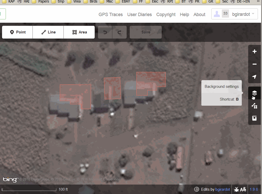
How to use Tasking Manager (in Japanese)

https://www.youtube.com/watch?v=Arco-pvxf88

How to adjust background imagery in iD editor

animated gif of adjust imagery in the iD editor

@mapconcierge
Copy link
Member Author

@mapconcierge
Copy link
Member Author

mapconcierge commented Sep 17, 2019

台風15号(Fah-sai) 2019 建物マッピング MEMO

概略EN

Typhoon Fah-sai attached Kanto region, Japan, 2019 September.
[on Wikipedia(in Japanese)](https://ja.wikipedia.org/wiki/%E4%BB%A4%E5%92%8C%E5%85%83%E5%B9%B4%E5%8F%B0%E9%A2%A8%E7%AC%AC15%E5%8F%B7)

Disaster Volunteer teams are working in this affected area.
We will support for them. First mission means making building data.
If you have time, please help to us. Thanks!!

概略JA

2019年9月の台風15号被害が房総半島全域及び伊豆諸島等広域に渡って広がっています。とくに風害としての屋根や窓等家屋の損壊、高圧電線、電柱などの電力網の寸断、断水などで、避難生活を続けています。
[on Wikipedia](https://ja.wikipedia.org/wiki/%E4%BB%A4%E5%92%8C%E5%85%83%E5%B9%B4%E5%8F%B0%E9%A2%A8%E7%AC%AC15%E5%8F%B7)

現地で活動する多くの災害ボランティアと連携し、彼らの活動エリアを中心にOpenStreetMapの建物データを充実させることを目的にこのタスクプロジェクトを立ち上げました。お時間ある方、ご協力よろしくお願い致します。

@mapconcierge
Copy link
Member Author

mapconcierge commented Jul 4, 2020

九州北部豪雨 2020 建物マッピング. 熊本県球磨川氾濫

概略EN

Typhoon Fah-sai attached Kanto region, Japan, 2019 September.
[on Wikipedia(in Japanese)](https://ja.wikipedia.org/wiki/%E4%BB%A4%E5%92%8C%E5%85%83%E5%B9%B4%E5%8F%B0%E9%A2%A8%E7%AC%AC15%E5%8F%B7)

Disaster Volunteer teams are working in this affected area.
We will support for them. First mission means making building data.
If you have time, please help to us. Thanks!!

概略JA

2019年9月の台風15号被害が房総半島全域及び伊豆諸島等広域に渡って広がっています。とくに風害としての屋根や窓等家屋の損壊、高圧電線、電柱などの電力網の寸断、断水などで、避難生活を続けています。
[on Wikipedia](https://ja.wikipedia.org/wiki/%E4%BB%A4%E5%92%8C%E5%85%83%E5%B9%B4%E5%8F%B0%E9%A2%A8%E7%AC%AC15%E5%8F%B7)

現地で活動する多くの災害ボランティアと連携し、彼らの活動エリアを中心にOpenStreetMapの建物データを充実させることを目的にこのタスクプロジェクトを立ち上げました。お時間ある方、ご協力よろしくお願い致します。

Special Project Notes

  • Please use Bing imagery.

  • You may need to align the imagery to the existing mapping - See below how to do that.

  • Buildings Only

  • Try to map individual buildings and not groups of buildings.

  • Please be careful not to change or affect existing mapping unless you are local or very experienced.

How to use Tasking Manager

https://youtu.be/lSLe6rjtgi0

How to adjust background imagery in iD editor

animated gif of adjust imagery in the iD editor

@mapconcierge
Copy link
Member Author

mapconcierge commented Mar 10, 2021

Requiem mapping for the 2011 Tōhoku earthquake and tsunami, Building/Roads Mapping. Natori, Miyagi, Japan

東日本大震災 2011 建物/道路 鎮魂マッピング. 宮城県名取市

Short description

The aftermath of the 2011 Tōhoku earthquake and tsunami included both a humanitarian crisis and massive economic impacts. The tsunami created over 300,000 refugees in the Tōhoku region of Japan, and resulted in shortages of food, water, shelter, medicine and fuel for survivors. 22,000 deaths have been confirmed. 
東日本大震災は、2011年3月11日(金) 14時46分18.1秒に発生した東北地方太平洋沖地震による災害およびこれに伴う福島第一原子力発電所事故による災害です。東日本各地での大きな揺れや、大津波、火災等により、東北地方を中心に12都道県で2万2000人余の死者(震災関連死を含む)・行方不明者が発生しました。これは明治以降の日本の地震被害としては関東大震災、明治三陸地震に次ぐ規模となりました。沿岸部の街を津波が破壊し尽くす様子や、福島第一原子力発電所におけるメルトダウン発生は、地球規模で大きな衝撃を与え、日本におけるクライシスマッピング活動の原点となりました。

Description

The aftermath of the 2011 Tōhoku earthquake and tsunami included both a humanitarian crisis and massive economic impacts. The tsunami created over 300,000 refugees in the Tōhoku region of Japan, and resulted in shortages of food, water, shelter, medicine and fuel for survivors. 22,000 deaths have been confirmed. 

This task project has been made for Requiem after 10 years of the earthquake.
Please update buildings and roads in disaster-affected areas.

![640px-SH-60B_helicopter_flies_over_Sendai](https://user-images.githubusercontent.com/416977/110702211-93d4b380-8235-11eb-888c-0ed55423fc2e.jpg)

Modified by @mapconcierge based on [Wikipedia., CC BY-SA 3.0](https://en.wikipedia.org/wiki/Aftermath_of_the_2011_T%C5%8Dhoku_earthquake_and_tsunami)
東日本大震災は、2011年3月11日(金) 14時46分18.1秒に発生した東北地方太平洋沖地震による災害およびこれに伴う福島第一原子力発電所事故による災害です。東日本各地での大きな揺れや、大津波、火災等により、東北地方を中心に12都道県で2万2000人余の死者(震災関連死を含む)・行方不明者が発生しました。これは明治以降の日本の地震被害としては関東大震災、明治三陸地震に次ぐ規模となりました。沿岸部の街を津波が破壊し尽くす様子や、福島第一原子力発電所におけるメルトダウン発生は、地球規模で大きな衝撃を与え、日本におけるクライシスマッピング活動の原点となりました。

このタスクプロジェクトは、東日本大震災から10年を経過し、その被災地の復興の状況を地図に反映するために、鎮魂マッピングとして公開しました。建物・道路の更新をお願いいたします。

![640px-SH-60B_helicopter_flies_over_Sendai](https://user-images.githubusercontent.com/416977/110702211-93d4b380-8235-11eb-888c-0ed55423fc2e.jpg)

[© Wikipedia, CC BY-SA 3.0](https://ja.wikipedia.org/wiki/%E6%9D%B1%E6%97%A5%E6%9C%AC%E5%A4%A7%E9%9C%87%E7%81%BD) をベースに[@mapconcerge](https://www.hotosm.org/people/taichi-furuhashi/) が改変

Changeset comment

Building/Roads Mapping in #Natori #hotosm-project-10530 #CrisisMappersJAPAN #FuruhashiLab #DRONEBIRD #YouthMappersAGU #amazonpsas

Detailed instructions

* Please use Bing or Maxar imagery with the latest data.
* You may need to align the imagery to the existing mapping - See below how to do that.
* Main Target features: Buildings and Roads
* If you have good experienced, please update waterways and land uses too.
* Try to map individual buildings and not groups of buildings.
* Please be careful not to change or affect existing mapping unless you are local or very experienced.

# How to adjust background imagery in iD editor
![animated gif of adjust imagery in the iD editor](https://wiki.openstreetmap.org/w/images/1/1a/Id-adjust-imagery.gif)
* 背景画像として Maxar や Bing などのうち最新の画像を用いてマッピングしてください。
* すでに入力されている建物などは、位置精度の高い国土地理院の空中写真を背景に位置合わせされています。MaxarやBing画像を使用する場合でも後述する位置合わせを既存データで行った上でマッピングすると高品質な地図となりますのでご協力よろしくお願いいたします。
* 初心者の方は建物や道路の更新をお願いします。
* 経験者は河川や土地利用など多様な地物の更新もお願いいたします。
* 建物はまとめて描かず、倉庫や小屋なども分離して個別に描いてください。
* 経験豊富なマッパーでない限り、既存の入力地物を変更したり影響を与えたりしないように注意してください。特に、意図せず地図オブジェクト(地物)を動かしてしまった場合は 編集画面右上の「元に戻す」ボタンで編集作業を戻してください。

# iD editorを用いた背景画像の位置補正方法
![animated gif of adjust imagery in the iD editor](https://wiki.openstreetmap.org/w/images/1/1a/Id-adjust-imagery.gif)

@mapconcierge
Copy link
Member Author

mapconcierge commented Jan 4, 2024

2024年1月1日令和6年能登半島地震用テンプレート(作業中)


Sea of Japan earthquake, 2024 Building and Road Mapping. Suzu, Ishikawa, Japan

令和6年能登半島地震 2024 建物・道路マッピング. 石川県珠洲市

Sea of Japan earthquake, 2024 Building and Road Mapping. Wajima, Ishikawa, Japan

令和6年能登半島地震 2024 建物・道路マッピング. 石川県輪島市

概略EN

The Noto Peninsula Earthquake of 2024 (Mw 7.5), which occurred on January 1, 2024, caused natural disasters such as building collapses, road damage, large-scale fires, landslides, tsunamis, and liquefaction in a wide area of the Noto Peninsula.
[on Wikipedia](https://en.wikipedia.org/wiki/2024_Sea_of_Japan_earthquake)

For the purpose of digitally archiving the situation of the affected areas where recovery and reconstruction activities are taking place, and for the purpose of linking with the GSI's GSI maps and many other digital map support activities used in various ways, the OpenStreetMap data of the affected areas will be further enriched and made available to many disaster volunteers working in the area, as well as to various. This task project was initiated to work with a number of local disaster relief volunteers and various aid organizations to enhance the OpenStreetMap building and street data used in some tools for background mapping and thematic mapping. This project will be a long-term project to record the current situation of the affected areas in OpenStreetMap over the medium to long term, rather than an urgent crisis mapping project such as emergency rescue. We would appreciate your cooperation in this project.

概略JA

2024年1月1日に発生した令和6年能登半島地震(Mw7.5)により、能登半島の広い範囲で建物倒壊、道路損壊、大規模火災、土砂災害、津波、液状化等の自然災害が発生しています。
[on Wikipedia](https://en.wikipedia.org/wiki/2024_Sea_of_Japan_earthquake)

![USGS_Intensity_Map_January_1_2024_Anamizu_Earthquake_M_7 5 pdf](https://github.com/dronebird/mapping/assets/416977/a0effcd6-f697-459d-a421-45ba91088094)

復旧復興活動が行われている被災地の状況をデジタルアーカイブし、様々な形で利用されている国土地理院の地理院地図やその他多くのデジタル地図支援活動と連携する目的で、被災地の OpenStreetMap データをより充実させ、現地で活動する多くの災害ボランティアや、様々な支援組織と連携し、いくつかのツールで背景地図や主題図作成に使われている OpenStreetMap の建物および道路データを充実させることを目的にこのタスクプロジェクトを立ち上げました。本プロジェクトは救急救命のような緊急性の高いクライシスマッピングというよりも中長期的に被災地の今をOpenStreetMapに記録していくための息の長いプロジェクトとしてすすめていきます。みなさまのご協力よろしくお願い致します。

Special Project Notes

* Please use [Custom / "Japan GSI seamlessphoto Imagery"](https://maps.gsi.go.jp/development/ichiran.html#seamlessphoto) as default. But you can compare "Bing Maps Aerial" and "Japan GSI Standard Map" as background imagery too.
* "Bing Maps Aerial" is more recent than "Japan GSI seamlessphoto Imagery", but Bing's position accuracy is lower than "Japan GSI seamlessphoto Imagery" and "Japan GSI Standard Map". Please compare and choose better background imagery. If quality is same, you should choose Custom / "Japan GSI seamlessphoto Imagery". :-)
* You may need to align the imagery to the existing mapping - See below how to do that.
* **Buildings and Road Only**
* Try to map individual buildings and not groups of buildings. 
* Try to map roads. 
* Please be careful not to change or affect existing mapping unless you are local or very experienced.

## How to use Tasking Manager
[https://youtu.be/lSLe6rjtgi0](https://youtu.be/lSLe6rjtgi0)

## How to adjust background imagery in iD editor
![animated gif of adjusting imagery in the iD editor](https://wiki.openstreetmap.org/w/images/1/1a/Id-adjust-imagery.gif)

Special Project Notes

* 背景画像はデフォルト設定の [カスタム / "国土地理院 全国最新写真(シームレス)"](https://maps.gsi.go.jp/development/ichiran.html#seamlessphoto) を使用してください。ただ、場合によって "Bing Maps Aerial" もしくは "国土地理院 標準地図" と比較して参考にすることも可能です。
* "Bing Maps Aerial" は "国土地理院 全国最新写真(シームレス)" よりも新しくて画像がクリアな場合が多いです。ただし、位置精度は "国土地理院 全国最新写真(シームレス)" や "国土地理院 標準地図" のほうが高いです。悩んだ場合は国土地理院の画像を優先しつつ、これらの背景画像を切り替えながら最適な画像を選択してください。
* 背景画像が既存の地図とずれる場合は、背景画像をオフセットして位置を合わせる必要がある場合があります。
* **建物と道路のみ。**
* 建物のグループではなく、個々の建物をマッピングしてみてください。
* 道路をマッピングするようにしてください。
* 現地の方、または経験豊富な方以外は、既存の地図に影響を与えないようご注意ください。

## タスクマネージャの使い方
[https://youtu.be/lSLe6rjtgi0](https://youtu.be/lSLe6rjtgi0)

## iDエディタで背景画像を調整する方法
![iDエディターで画像を調整するアニメーションgif](https://wiki.openstreetmap.org/w/images/1/1a/Id-adjust-imagery.gif)

@mapconcierge
Copy link
Member Author

mapconcierge commented Jan 4, 2024

hoge

Sign up for free to join this conversation on GitHub. Already have an account? Sign in to comment
Projects
None yet
Development

No branches or pull requests

2 participants