Skip to content
New issue

Have a question about this project? Sign up for a free GitHub account to open an issue and contact its maintainers and the community.

By clicking “Sign up for GitHub”, you agree to our terms of service and privacy statement. We’ll occasionally send you account related emails.

Already on GitHub? Sign in to your account

active fire data from NASA #7

Open
njtierney opened this issue Jan 3, 2020 · 2 comments
Open

active fire data from NASA #7

njtierney opened this issue Jan 3, 2020 · 2 comments

Comments

@njtierney
Copy link
Collaborator

https://earthdata.nasa.gov/earth-observation-data/near-real-time/firms/active-fire-data

@Lingtax
Copy link
Contributor

Lingtax commented Jan 3, 2020

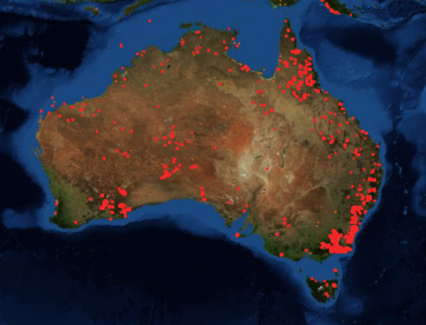
It's been pointed out that there's no national fire extent map, with the best being a google overlay drawing in the CAP data from the state emergency services. Might we be able to build a national map from this data until all the states converge on data release?

@njtierney
Copy link
Collaborator Author

I've seen a few fire maps from news outlets, but not sure where they got the data

The Sun (UK):

myfirewatch (WA):
image

CBS News:

It looks like the guardian has referenced data:

Sign up for free to join this conversation on GitHub. Already have an account? Sign in to comment
Labels
None yet
Projects
None yet
Development

No branches or pull requests

2 participants